Advanced Aerial Solutions for Smarter Operations

Harness the power of AI to analyze video streams in real-time. Detect objects, recognize faces, track movements, and unlock insights that drive smarter decisions.

Perimeter Intrusion | Object Tracking | Object Counting | People Counting | Facial Recognition | Behavior Analysis | ANPR & Speed | Custom Solution

Integrated Drone Technology Solutions: Advanced Aerial Solutions for Smarter Operations

Elevate your operational perspective with autonomous aerial frameworks that transcend ground-based limitations, providing real-time intelligence and rapid response capabilities for complex environments.

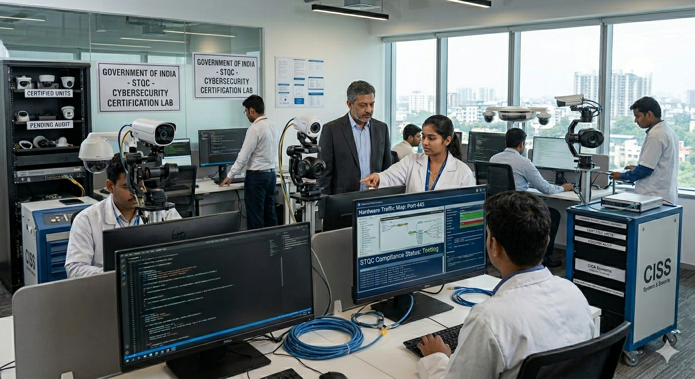
FORTIA engineers the overhead intelligence layer of modern enterprise security by deploying sophisticated drone-in-a-box and piloted aerial systems. We bridge the gap between static surveillance and dynamic intervention, ensuring that your mission-critical aerial data flows through a secure, AI-driven architecture designed for high-stakes environments.


Autonomous Persistent Surveillance

Deploy a high-performance aerial foundation capable of 24/7 site monitoring without manual intervention. From automated docking stations to scheduled patrol routes, we design aerial networks that eliminate blind spots and provide the visual stability required for high-level perimeter integrity.

Automated Drone-in-a-Box Hubs: Deploys weather-hardened docking stations to ensure instantaneous launch and recovery for mission-critical security patrols.

AI-Driven Perimeter Patrols: Dynamically routes flight paths to prevent security gaps, guaranteeing consistent coverage across remote or vast industrial locations.

High-Resolution Thermal Imaging: Supports massive data streams from multispectral sensors, allowing for seamless detection of heat signatures or intruders without compromising image clarity.

Unified Aerial Intelligence Systems

Break down data silos with integrated aerial video and telemetry platforms. Our solutions ensure seamless connectivity between your drone fleet and command center, enabling real-time collaboration between ground operators and aerial assets.


Converged Air-to-Ground Data Architecture: Merges live drone feeds directly into existing VMS platforms, reducing operational overhead while enabling real-time collaboration

Military-Grade Encrypted Downlinks: Protects sensitive aerial telemetry and video with advanced cryptographic protocols, ensuring secure data exchange during critical sorties.

Automated Failover Flight Protocols: Ensures safe asset recovery during primary link failures by instantly triggering "Return to Home" or redundant GPS paths, maintaining equipment safety.

Edge Processing & Rapid Deployment

Protect your facility with drones capable of processing data at the edge for immediate threat verification. We prioritize uptime and rapid response, ensuring your aerial infrastructure remains operational during emergency scenarios or peak security alerts.


On-Board Edge Computing: Processes critical AI analytics locally on the drone to reduce bandwidth strain and provide localized threat detection even during network outages.

Hardened Anti-Jamming Technology: Integrates resilient GPS and frequency-hopping links, creating a multi-layered shield that protects aerial hardware from electronic interference.

Scalable Fleet Management: Features rapid-deployment architectures that grow with your site, providing high-density aerial coverage that integrates into centralized command software.

Scalable Aerial Frameworks for Global Standards

Find the hardware that fits your security strategy.


AI-Powered Object Recognition

Deploy neural-network-enhanced cameras that identify and track vehicles, personnel, or anomalies across thousands of acres without signal degradation.

Beyond Visual Line of Sight (BVLOS)

Empower your security force with low-latency remote piloting and Zero Trust control for secure "anywhere" aerial operations.

Intelligent Fleet Swarming:

Automatically distribute patrol tasks across multiple drones to prevent coverage bottlenecks and ensure 24/7 availability of overhead eyes.

Converged Infrastructure Mapping

Consolidate LiDAR, photogrammetry, and security data onto a single managed platform to reduce maintenance costs and improve site planning.

Emergency Response Readiness

Implement automated "Scramble" triggers linked to ground sensors to ensure near-zero response time during unforeseen security breaches.

Regulatory Compliance Excellence

Standardize your aerial layer with automated flight logging and airspace deconfliction, designed for easy scalability and simplified audit trails.

The FORTIA Aerial Layer: Why Elevation Matters

A facility is only as secure as its ability to see beyond the fence line. By investing in professional Integrated Drone Technology, FORTIA provides:


Resilient Drone Infrastructure Pillars:

Zero-Latency Aerial Response:

Ensure your drone triggers and live feeds act in milliseconds, providing an immediate tactical advantage.

Hardened Sky-Cybersecurity:

Protect your aerial assets and flight controllers from digital hijacking with multi-layered signal defense.

Infinite Fleet Scalability:

Add new drones, docking stations, or sensor types without needing to overhaul your core command center software.

Start building your security solution today

Find the right AI-enabled technology to support your video security system and help protect what matters most.


Shopping Cart0

No products in the cart.

wpChatIcon
wpChatIcon